


About This Station
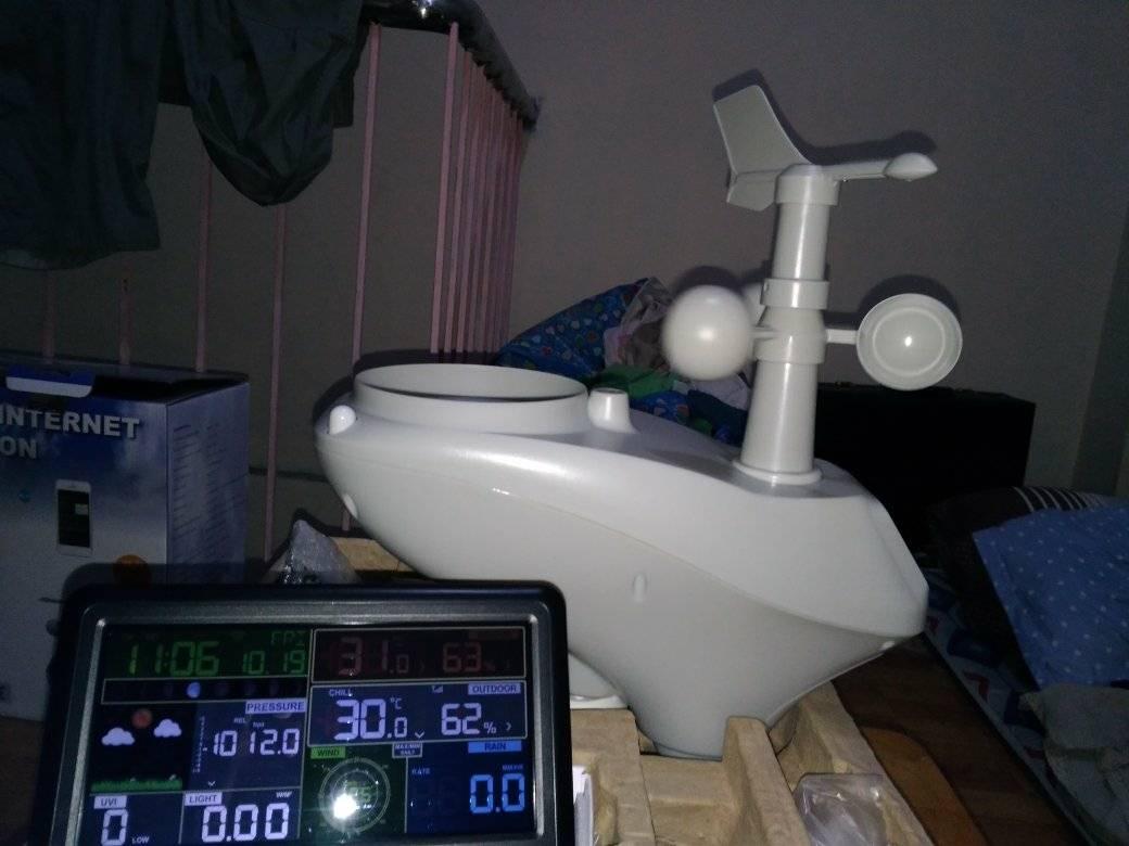
This Station is located at Barangay #60 Baltazar St. Caloocan City at the roofdeck building in front of our home in Philippines. This station of mine uses Weather Display v 10.37S Build 44 Software. The station uses either a selected Davis Vantage Vue ISS / Ambient Weather WS-1001 or Osprey 1200 Observer and it is comprised of an anemometer, a rain gauge and a thermo-hydro sensor with Solar and UV sensor included, WIRELESSLY its console in my room for situated in optimal positions and running 24/7 and updates the DATA within 10 seconds or less as fast as possible depending on the web trafic conditions worldwide.
The SEISMOMETER I'm using is my own designed GBSR-AS1 which is based from Lehman Seismometer that can sense quakes around the world above 4.0 magnitudes.
About Caloocan City and Project areas
Caloocan, officially the City of Caloocan (Tagalog: Lungsod ng Caloocan), or simply known as Caloocan City, is a 1st class highly urbanized city in Metro Manila, Philippines. According to the 2015 census, it has a population of 1,583,978 people[3] making it the fourth-most populous city in the Philippines. It is divided into two geographical locations with a total combined area of 5,333.40 hectares. It was formerly part of the Province of Rizal of the Philippines' Southern Luzon Region. The city's name is colloquially spelled as Kalookan. It comprises what is known as the CAMANAVA area along with cities Malabon, Navotas and Valenzuela. The word caloocan comes from the Tagalog root word lo-ok; kalook-lookan (or kaloob-looban) means "innermost area". South Caloocan is bordered by Manila, Quezon City, Malabon, Navotas and Valenzuela. North Caloocan shares its border with Quezon City, Valenzuela and Marilao, Meycauayan and San Jose del Monte in the province of Bulacan.
About This Website and Credits:
This site is the Original template design by CarterLake.org with PHP conversion by Saratoga-Weather.org.
Special thanks go to Kevin Reed at TNET Weather for his work on the original Carterlake templates, and his design for the common website PHP management.
Special thanks to Mike Challis of Long Beach WA for his wind-rose generator, Theme Switcher and CSS styling help with these templates.
Special thanks go to Ken True of Saratoga-Weather.org for the AJAX conditions display, dashboard and integration of the TNET Weather common PHP site design for this site.
Special thanks to David Michael Padua of TYPHOON2000.PH for his detailed images for Graphical Analysis and his Multitrack analysis contribution in weatherPH organization in delivering exact weather movements, and his contribution to our weather government if my research is correct, and to help Identify the names of Typhoons inside our PAR system. His passion in weather makes me do my passion in weather systems too.
For Tropical Cyclone Warning Advisories and images Courtesy of Joint Typhoon Warning Center for its detailed images for tropical Cyclone Advisories and their network to provide a detail for possible Cyclone developments and weather movements.
Template is originally based on Designs by Haran.
Realtime weather SEA map courtesy by Accuweather.
THERMAL Volcanic Logs and Imaging, courtesy of MIROVA.
Updated image graphic GFS and NAVGEM track mapping analysis are Credited to tropicaltidbits.com.
Cloud base graphic courtesy of Bashewa Weather
Doppler Radar, Water vapor, RSMC feed and precipitation Satellite images are courtesy to: CLIMATEX and DOST PAGASA and NOAA. Also for Global Mean Temperature and its data feed Courtesy of MET Office
Local Philippine Earthquake data feed, courtesy to: Phivolcs
Air Quality index monitoring SCRIPT, courtesy to: leuven-template.eu/ and AURORAL Live Snapshots is Credited to: AURORAMAX
ASTRONOMICAL Events and Calendar, courtesy to: in-the-sky.org/ and eclipsewise for Eclipse events
Weather Forum visit at WxForum