TROPICAL CYCLONE ADVISORY: ABPW10 PGTW 170600 MSGID/GENADMIN/JOINT TYPHOON WRNCEN PEARL HARBOR HI// SUBJ/SIGNIFICANT TROPICAL WEATHER ADVISORY FOR THE WESTERN AND SOUTH PACIFIC OCEANS/170600Z-180600ZJUN2026// RMKS/ 1. WESTERN NORTH PACIFIC AREA (180 TO MALAY PENINSULA): A. TROPICAL CYCLONE SUMMARY: NONE. B. TROPICAL DISTURBANCE SUMMARY: (1) THE AREA OF CONVECTION (INVEST 92W) PREVIOUSLY LOCATED NEAR 10.4N 154.4E IS NOW LOCATED NEAR 11.7N 151.6E, APPROXIMATELY 417 NM EAST-SOUTHEAST OF GUAM. ANIMATED ENHANCED MULTISPECTRAL SATELLITE IMAGERY (EIR) DEPICTS BROAD CYCLONIC TURNING ASSOCIATED WITH INVEST 92W, ACCOMPANIED BY INTERMITTENT FLARING CONVECTION. THE SYSTEM REMAINS POORLY ORGANIZED, WITH AN ILL-DEFINED LOW-LEVEL CIRCULATION CENTER (LLCC) THAT MAY INSTEAD REPRESENT THE CUSP OF A LOW-LEVEL WAVE. ENVIRONMENTAL ANALYSIS FOR THE AREA INDICATES CONDITIONS FAVORABLE FOR DEVELOPMENT, WITH LOW VERTICAL WIND SHEAR (10-15 KNOTS), MODERATE POLEWARD OUTFLOW ALOFT, AND WARM SEA SURFACE TEMPERATURES (29-30 C). AS THE SYSTEM IS CURRENTLY WEAK AND DISORGANIZED, THE PACE OF DEVELOPMENT WILL LIKELY BE SLOW IN THE NEAR TERM. DETERMINISTIC MODELS ARE CONSISTENT WITH THIS ASSESSMENT, SHOWING VERY GRADUAL DEVELOPMENT OVER THE NEXT 48 HOURS, AND ARE SPLIT ON WHETHER A TROPICAL CYCLONE WILL FORM BY THAT TIME. GLOBAL MODELS AGREE ON A GENERALLY WEST-NORTHWESTWARD TRACK, TAKING THE SYSTEM INTO THE VICINITY OF THE SOUTHERN MARIANA ISLANDS. THE EXACT TRACK WILL DEPEND ON WHERE A WELL-DEFINED LLCC ULTIMATELY CONSOLIDATES. MAXIMUM SUSTAINED SURFACE WINDS ARE ESTIMATED AT 18 TO 23 KNOTS. MINIMUM SEA LEVEL PRESSURE IS ESTIMATED TO BE NEAR 1008 MB. THE POTENTIAL FOR THE DEVELOPMENT OF A SIGNIFICANT TROPICAL CYCLONE WITHIN THE NEXT 24 HOURS REMAINS MEDIUM. (2) NO OTHER SUSPECT AREAS. C. SUBTROPICAL SYSTEM SUMMARY: NONE. 2. SOUTH PACIFIC AREA (WEST COAST OF SOUTH AMERICA TO 135 EAST): A. TROPICAL CYCLONE SUMMARY: NONE. B. TROPICAL DISTURBANCE SUMMARY: NONE. C. SUBTROPICAL SYSTEM SUMMARY: NONE.// NNNN
THUNDERSTORM (c/o PAGASA)

Thunderstorm Advisory No. 14 #VISPRSD
Issued at 08:04 PM 17 June 2026

Moderate to Heavy rainshowers with lightning and strong winds are expected over #Iloilo(IloiloCity, Leganes), #Guimaras(Jordan, NuevaValencia), #NegrosOccidental(Hinigaran, Pontevedra, LaCarlotaCity, Murcia, BagoCity), #Samar(Villareal), #Leyte(Carigara, Capoocan, Kananga), #Biliran(Cabucgayan, Caibiran and Culaba) within the next 30 minutes to an hour.

The above conditions are being experienced in #Guimaras(Buenavista), #NegrosOccidental(LaCastellana, SanCarlosCity), #Samar(SantaRita, Pinabacdao, Basey, Calbiga, SanSebastian, Marabut, Daram, Zumarraga, Hinabangan), #EasternSamar(CityOfBorongan), #NegrosOriental(CanlaonCity, Vallehermoso, Mabinay and Manjuyod) which may persist within 1 to 2 hours and may affect nearby areas.

Published by: VISPRSDValid until: Jun 17, 2026 10:04 PM
Affected Areas: Iloilo, Guimaras, Negros Occidental, Samar, Eastern Samar + 3 more
THUNDERSTORM

Thunderstorm Advisory No. 5 #MINPRSD
Issued at 08:00 PM 17 June 2026

Moderate to occasionally heavy rainshowers with lightning and strong winds are expected over #AgusanDelSur, #SurigaoDelSur(Tagbina, Lianga, SanAgustin, Marihatag, Cagwait, Bayabas, SanMiguel, Tago, CityOfTandag, Lanuza, Cortes, Barobo, Hinatuan), #MisamisOriental(CagayanDeOroCity, Naawan, Manticao, Lugait, Alubijid, Initao, Tagoloan, Medina, Salay, Opol, CityOfElSalvador, Gitagum, Libertad, Balingasag, Lagonglong, Jasaan, Villanueva, Claveria, GingoogCity, Magsaysay, Laguindingan), #DinagatIslands, #SurigaoDelNorte, #AgusanDelNorte, #DavaoOriental(Caraga, Manay, Tarragona, SanIsidro, GovernorGeneroso, CityOfMati, Lupon, Banaybanay), #LanaoDelNorte(IliganCity, Linamon, PoonaPiagapo, Munai, Kolambugan, Tangcal, Matungao, PantaoRagat, Baloi, Tagoloan, Pantar), #LanaoDelSur(MarawiCity, Marantao, Piagapo, Balindong, Saguiaran, Bumbaran, TagoloanII, Kapai, Bubong, DitsaanRamain, BuadiposoBuntong, Maguing, Mulondo, Taraka), #NorthCotabato(Alamada, Carmen), #Bukidnon(Kalilangan, Kadingilan, Pangantucan, Baungon, ManoloFortich, Libona, Talakag), #DavaoDeOro(Monkayo, Compostela, NewBataan), #ZamboangaDelNorte(LeonB.Postigo, Siayan, Manukan, JoseDalman, Pres.ManuelA.Roxas, Katipunan, Polanco and DipologCity) within the next 1-2 hours.

The above conditions are being experienced in #SurigaoDelSur(Lingig, CityOfBislig, Carmen, Madrid, Cantilan, Carrascal), #MisamisOriental(Talisayan, Balingoan, Kinoguitan, Sugbongcogon, Binuangan), #Camiguin, #DavaoOriental(Boston, Cateel, Baganga), #LanaoDelNorte(Maigo, Bacolod, Kauswagan), #NorthCotabato(Banisilan), #LanaoDelSur(Wao) and #ZamboangaDelNorte(Sindangan) which may persist within 1-2 hours and may affect nearby areas.

Published by: MINPRSDValid until: Jun 17, 2026 10:00 PM
Affected Areas: Agusan del Sur, Surigao del Sur, Misamis Oriental, Camiguin, Dinagat Islands + 11 more
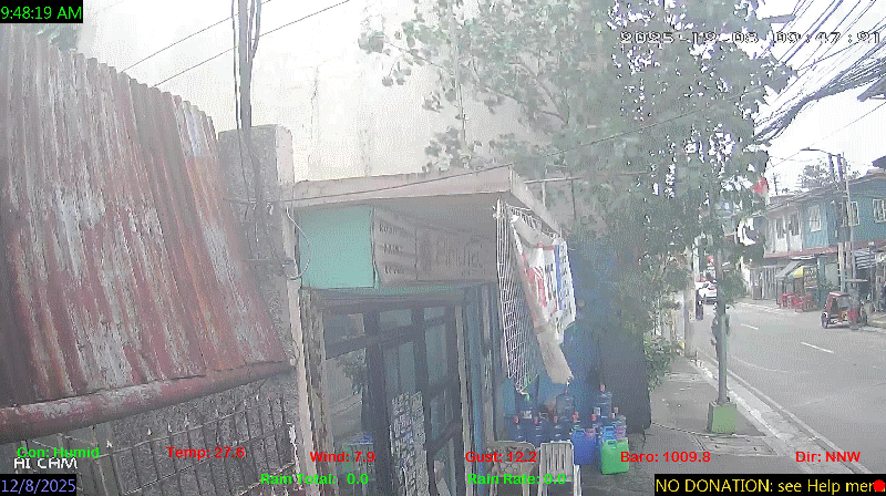
spacer
METRIC | IMPERIAL
Updated: 06/17/2026 @ 8:00pm  
Temperature Current Conditions Forecast / Storm Prediction
Outside Temperature: Colder 0.8°C than last hour.

31.7°C

Heat Index:  41.0°C
Feels like:  41°C
Warm
Indoor Temperature

98.8°C

Max Humidex:  45.7°C
Indoor Humidity: %
High Today
35.5°C
3:00 PM
Low Today
26.7°C
5:29 AM
Yest High
34.8°C
1:44 PM
Yest Low
26.6°C
3:25 AM
Sta* High
37.0°C
4/28/2026
Sta* Low
0.0°C
5/5/2026
Space Weather Status
X-Ray: B7.5 Max: B5.6
NORMAL
Geomagnetic Field: 2.33
QUIET
Few Clouds Few Clouds ,
Few Clouds

Wind from NNE Wind:  NNE
0.4

Gusting to:
4.0 km/h
Current Rain Rain Total:
0.0 mm
Rain Warning Rain Rate:
Chandler Burning Index: LOW Current CBI
Fire Danger:
3.7 % of 100%
LA NINA / EL NINO
Wednesday
Partially cloudy rain
Partially cloudy with 37°C
28°C
Thursday
Rain, Partially cloudy rain
Rain, Partially cloudy with 34°C
27°C
Friday
Rain, Partially cloudy rain
Rain, Partially cloudy with 34°C
26°C
Official Record High
92W INVEST LPA 37 kph OUTSIDE PAR
VOLCANO THERMAL ALERT STATUS
TAAL
Volcano Alert Status
MAYON
Volcano Alert Status
PINATUBO
Volcano Alert Status
Dew Point Liquid Precipitation Wind Speed Sun/Moon
Current: Decreased 0.1°C since last hour. 26.5°C
Last Hour: Decreased 0.1°C since last hour. 0.1°C
High 3:00 PM: 29.2°C
Low 5:52 AM: 25.1°C
Record High: 31.0°C on
May-26-2026
Record Low: 16.2°C on
Mar-14-2026
Wetbulb: 27.9°C


Today: 0.00 mm
Yesterday: 3.00 mm
Last 7 Days: 32.40 mm
Jun Rain: 183.30 mm
Jun to Date
  Avg:10
0.00 mm
Jun to Date
  Diff from Avg:10
Over 183.3 mm for the month 183.30 mm
Jun Avg: 296.10 mm
Diff from Avg: Under 112.8 mm for the month 112.80 mm
Season:1 349.8 mm
YTD
  Avg:11
366.30 mm
YTD
  Diff from Avg:11
Under 16.5 mm for the year 16.50 mm
Last Rain
Time/Date:
Jun-16-2026
at 4:02 PM
40 rain days in 2026
9 days in June
0 days since last rain
Current: NNE  0.4 km/h
Highest Speed: 20.4 km/h
1Hr Average: 1.6 km/h
Wind Run: 78.16 km
Wind Gust
Current: 4.0 km/h
Today: 48.2 km/h 4:55 PM
Month: 92.9 km/h Jun-1
Year: 116.9 km/h May-29
Record Gust: 116.9 km/h
May-29-2026
Sunlight:
12 hrs 59 min 34 sec
of Sunlight Today
Which is 4 sec Longer
Than Yesterday


(Noon)
graph (Midnight)

Highslide JS
Evening Crescent, 2 days, 9 hours, 22 minutes in cycle
7%
Illuminated
Outside Humidity Barometer
Current: Increased 3% since last hour. 74%
Last Hour: Increased 3% since last hour. 3%
High 5:12 AM: 92%
Low 1:55 PM: 68%
Record High: 99%
Dec-10-2025
Record Low: 0%
May-5-2026
Current: Rising 0.8  hPa/hr 1009.5 hPa
Last Hour: Rising
High 7:06 AM: 1010.8
Low 3:58 PM: 1006.4
Record High: 1017.0 hPa
Jan-24-2026
Record Low: 1001.5 hPa
May-12-2026
Cooling Degree Days Tide Heat Index Air Quality
Today: 8.8
Jun: 182.0
2026 to Date: 1412.3
Heating Degree Days
2026 to Date: 0.0

12 hours, 32 minutes to falling: tide at
08:48 AM PST


Current: 41.0°C
High 3:00pm: 52.2°C
Yesterday: 51.3°C
Record: 56.5°C
May-26-2026

38

Good

PM2.5: 9.2 ug/m3 PM10: 20.35 ug/m3

Last Updated: 2026-06-17 20:16:49 PHT
UV Summary/Forecast Solar Summary
High Today:   11.0 @ 11:29 AM
Jun-18

11.6
Jun-19

11.6
Jun-20

12.0
High Today:  
749 W/m2 @ 11:29 AM
Sun Hours Today:
01:56
   This Month: 28:41 Hrs
Rise: 5:27 am  Set: 6:26 pm
Almanac Irrigation Index5 Station All Time Records Cloud Level
Currently: Evening
YTD Avg Temp: 28.3°C
Sunrise: 5:27 am
Sunset: 6:26 pm
Moonrise: 7:31 am
Moonset: 8:53 pm
Full Moon: 23:57 UTC June 29 2026
Next Eclipse:
Image
12 Aug 2026 (57 days away): Total solar eclipse Thu, 13 Aug 2026 01:47:00 AM PST
Updated at Midnight
Current ET: 2.10 mm
7-Days Rain: 32.40 mm
7-Days ET: 13.10 mm
7-Day:  19.3 mm water in excess of what evaporated in last 7 days. 19.3 mm
June:  154.8 mm water in excess of what evaporated this month. 154.8 mm
Solar HF Condition
HIGHS: LOWS:
37.0°C
Apr-28-2026
0.0°C
May-5-2026
Daytime Records
  34.2°C
May-03-2026
  23.4°C
Dec-20-2025
Nitetime Records
  31.6°C
Apr-05-2026
  23.4°C
Jan-02-2026
ICN:4 | S3C2:5 | Ajax 3.xx
ISS:Ok | CON:%vpconsolebattery% | RCP:%vpreception2%
METRIC | IMPERIAL
Updated: 06/17/2026 @ 8:00pm  
1 Rain season in the Philippines: June 1st to Oct 31st.   5 Estimated amount of water needed to replace the water used by plants and evaporation from the past week. (Negative numbers mean amount of water needed, positive numbers mean excess water is present).   6 Air Quality Index is provided by Luftdaten System esp8266 and is updated every 5 mins..   10 Historical average only to day 17 of just the month of June for this station since 2016.   11 Historical average rain this season to day 17 of June for this station since 2016.
 VC Weather Forecast  -   with local Weather Outlook for Wednesday & Thursday
Wednesday
Partially cloudy rain
Partially cloudy
37°C
28°C
VC forecast: Partly cloudy throughout the day. Chance of precipitation (rain) 23%. High: 37°C. Low: 28°C. Wind E 15->13 km/h. UV Index 5.
Local Weather Advisory:

Easterlies affecting Southern Luzon, Visayas and the eastern section of Mindanao.
Thursday
Rain, Partially cloudy rain
Rain, Partially cloudy
34°C
27°C
VC forecast: Becoming cloudy in the afternoon with storms possible. Chance of precipitation (rain) 71%. High: 34°C. Low: 27°C. Wind SSE 14->14 km/h. UV Index 9.
 VC Short Term Weather Forecast
Friday
Rain, Partially cloudy rain
Rain, Partially cloudy
Saturday
Partially cloudy rain
Partially cloudy
Sunday
Rain, Partially cloudy rain
Rain, Partially cloudy
Monday
Rain, Partially cloudy rain
Rain, Partially cloudy
Tuesday
Rain, Partially cloudy rain
Rain, Partially cloudy
Wednesday
Rain, Partially cloudy rain
Rain, Partially cloudy
Thursday
Rain, Overcast rain
Rain, Overcast
34°C
26°C
34°C
27°C
35°C
27°C
33°C
27°C
32°C
26°C
33°C
26°C
33°C
27°C
Version 6.95 - 05-Jan-2016 - Script Mods by: BurnsvilleWeatherLIVE.com