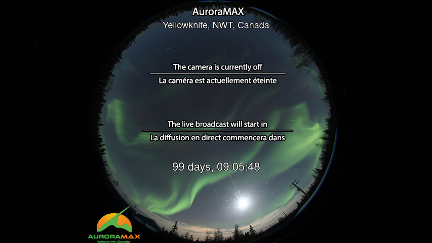
2026-08-19 04:52 AM EXTENDED WARNING: Geomagnetic K-index of 4 expected Extension to Serial Number: 5404 Valid From: 2026 Aug 17 2101 UTC Now Valid Until: 2026 Aug 19 1800 UTC Warning Condition: Persistence Potential Impacts: Area of impact primarily poleward of 65 degrees Geomagnetic Latitude. Induced Currents - Weak power grid fluctuations can occur. Aurora - Aurora may be visible at high latitudes such as Canada and Alaska. TROPICAL CYCLONE ADVISORY: ABPW10 PGTW 180600 MSGID/GENADMIN/JOINT TYPHOON WRNCEN PEARL HARBOR HI// SUBJ/SIGNIFICANT TROPICAL WEATHER ADVISORY FOR THE WESTERN AND SOUTH PACIFIC OCEANS/180600Z-190600ZAUG2026// REF/A/MSG/JOINT TYPHOON WRNCEN PEARL HARBOR HI/180552ZJUN2021// AMPN/REF A IS A TROPICAL CYCLONE FORMATION ALERT.// RMKS/ 1. WESTERN NORTH PACIFIC AREA (180 TO MALAY PENINSULA): A. TROPICAL CYCLONE SUMMARY: NONE. B. TROPICAL DISTURBANCE SUMMARY: (1) THE AREA OF CONVECTION (INVEST 92W) PREVIOUSLY LOCATED NEAR 9.2N 157.8E IS NOW LOCATED NEAR 7.9N 154.9E, APPROXIMATELY 181 NM EAST OF CHUUK. ANIMATED MULTISPECTRAL SATELLITE IMAGERY (MSI) DEPICTS 92W AS A QUICKLY DEVELOPING LOW LEVEL CIRCULATION CENTER (LLCC) WITH FLARING CONVECTION CONFINED TO THE SOUTHERN SEMICIRCLE. AN ASCAT 082257Z PASS REVEALED AN ELONGATED LLCC WITH THE STRONGEST ASSOCIATED WINDS (20-25 KNOTS) WRAPPING ON THE SOUTHEASTERN SIDE. ENVIRONMENTAL ANALYSIS REVEALS FAVORABLE CONDITIONS FOR DEVELOPMENT WITH LOW (10 TO 15KTS) VERTICAL WIND SHEAR, GOOD EQUATORWARD OUTFLOW, AND WARM (29-30 C) SEA SURFACE TEMPERATURES. GLOBAL MODELS ARE IN GOOD AGREEMENT THAT 92W WILL CONTINUE TO INTENSIFY WHILE TRANSITING NORTH-NORTHWESTWARD. ENSEMBLE MODELS SHOW THE RAPID DEVELOPMENT OF 92W INTO A TROPICAL DEPRESSION AND AGREE WITH DETERMINISTIC MODELS ON A SIMILAR TRACK WITHIN A 24 HOUR PERIOD. MAXIMUM SUSTAINED SURFACE WINDS ARE ESTIMATED AT 18 TO 23 KNOTS. MINIMUM SEA LEVEL PRESSURE IS ESTIMATED TO BE NEAR 1005 MB. THE POTENTIAL FOR THE DEVELOPMENT OF A SIGNIFICANT TROPICAL CYCLONE WITHIN THE NEXT 24 HOURS IS UPGRADED TO HIGH. SEE REF A (WTPN21 PGTW 180600) FOR FURTHER DETAILS. (2) THE AREA OF CONVECTION (INVEST 94W) PREVIOUSLY LOCATED NEAR 19.5N 132.5E IS NOW LOCATED NEAR 19.7N 131.5E, APPROXIMATELY 445 NM SOUTH-SOUTHEAST OF KADENA. THE SYSTEM IS CURRENTLY CLASSIFIED AS A MONSOON DEPRESSION, GENERALLY CHARACTERIZED AS A VERY LARGE CYCLONIC CIRCULATION, GREATER THAN 600NM DIAMETER AND EXTENSIVE ELEVATED WINDS OVER THE SOUTHEASTERN PERIPHERY AND A WEAK CORE OF LIGHT WINDS. ANIMATED MULTISPECTRAL SATELLITE IMAGERY (MSI) DEPICTS 94W AS AN AREA OF BROAD TURNING, WITH CONVECTION BUILDING ON THE EAST-SOUTHEASTERN PERIPHERY. ENVIRONMENTAL ANALYSIS REVEALS MARGINALLY FAVORABLE CONDITIONS FOR DEVELOPMENT WITH LOW (10 TO 15KTS) VERTICAL WIND SHEAR, AND WARM (29-30 C) SEA SURFACE TEMPERATURES THAT ARE CONDUCIVE FOR FURTHER DEVELOPMENT OFFSET BY SUPPRESSED OUTFLOW DUE TO AN UPPER-LEVEL LOW ALOFT. GLOBAL MODELS INDICATE THAT 94W WILL TRANSIT NORTH- NORTHWESTWARD BUT DOES NOT CONSOLIDATE INTO A TROPICAL CYCLONE. ENSEMBLE MODELS AGREE ON A SIMILAR TRACK AND INTENSITY AS THE GLOBAL MODELS OVER THE NEXT 48 HOURS. REFERENCE THE FLEET WEATHER CENTER SAN DIEGO HIGH WINDS AND SEAS PRODUCT OR REFER TO LOCAL WMO DESIGNATED FORECAST AUTHORITY. MAXIMUM SUSTAINED SURFACE WINDS ARE ESTIMATED AT 23 TO 27 KNOTS. MINIMUM SEA LEVEL PRESSURE IS ESTIMATED TO BE NEAR 1002 MB. THE POTENTIAL FOR THE DEVELOPMENT OF A SIGNIFICANT TROPICAL CYCLONE WITHIN THE NEXT 24 HOURS REMAINS LOW. (3) THE AREA OF CONVECTION (INVEST 95W) PREVIOUSLY LOCATED NEAR 19.9N 117.4E IS NOW LOCATED NEAR 19.5N 117.2E, APPROXIMATELY 236 NM SOUTHEAST OF HONG KONG. ANIMATED MULTISPECTRAL SATELLITE IMAGERY (MSI) DEPICTS 95W AS A WEAK AREA OF TURNING WITH DISORGANIZED CONVECTION. ENVIRONMENTAL ANALYSIS REVEALS MARGINAL CONDITIONS FOR DEVELOPMENT WITH LOW TO MODERATE EASTERLY VERTICAL WIND SHEAR (15 TO 20 KTS), WARM (29 TO 30 C) SEA SURFACE TEMPERATURES, AND MODERATE EQUATORWARD OUTFLOW. FOR GLOBAL MODELS, GFS IS THE ONLY MODEL TO DEVELOP 95W INTO A CONSOLIDATED CYCLONE. ENSEMBLE MODELS DO SHOW THE STEADY DEVELOPMENT OF 95W, AND FOR IT TO TAKE A GENERAL SLOW WEST-NORTHWESTWARD TRACK OVER THE NEXT 48 HOURS. MAXIMUM SUSTAINED SURFACE WINDS ARE ESTIMATED AT 13 TO 17 KNOTS. MINIMUM SEA LEVEL PRESSURE IS ESTIMATED TO BE NEAR 1002 MB. THE POTENTIAL FOR THE DEVELOPMENT OF A SIGNIFICANT TROPICAL CYCLONE WITHIN THE NEXT 24 HOURS REMAINS LOW. (4) NO OTHER SUSPECT AREAS. C. SUBTROPICAL SYSTEM SUMMARY: NONE. 2. SOUTH PACIFIC AREA (WEST COAST OF SOUTH AMERICA TO 135 EAST): A. TROPICAL CYCLONE SUMMARY: NONE. B. TROPICAL DISTURBANCE SUMMARY: NONE. C. SUBTROPICAL SYSTEM SUMMARY: NONE.// NNNN
RAINFALL (c/o PAGASA)

Heavy Rainfall Warning No. 22 #NCR_PRSD
Weather System: Southwest Monsoon (Habagat)
Issued at: 11:00 AM, 19 August 2026(Wednesday)

RED WARNING LEVEL: Bataan, Zambales(Botolan, San Marcelino, Cabangan, Iba, Olongapo, Subic, Castillejos, San Antonio, San Felipe, San Narciso), Cavite(Tanza, Ternate, Cavite City, Naic, Noveleta, Rosario, Maragondon, Magallanes, General Trias), Batangas(Lian, Nasugbu, Balayan, Tuy, Calatagan), Tarlac(Bamban, Capas, San Jose), Pampanga(Porac, Floridablanca, Macabebe, Masantol, Sasmuan, Lubao, Guagua, Santa Rita, Minalin, Angeles, Mabalacat) and Bulacan(Hagonoy, Paombong).
ASSOCIATED HAZARD: Serious FLOODING in flood-prone areas.

ORANGE WARNING LEVEL: Metro Manila, Zambales(Candelaria, Santa Cruz, Masinloc, Palauig), Cavite(Alfonso, Amadeo, General Emilio Aguinaldo, Indang, Mendez, Silang, Tagaytay, Trece Martires, Carmona, Dasmarinas, Gen. Mariano Alvarez, Bacoor, Kawit, Imus), Batangas(Agoncillo, Alitagtag, Batangas City, Bauan, Calaca, Cuenca, Laurel, Lemery, Mabini, San Jose, San Luis, San Nicolas, San Pascual, Santa Teresita, Taal, Talisay, Tingloy), Tarlac(Concepcion, Anao, Tarlac City, Gerona, La Paz, Paniqui, Pura, Ramos, San Manuel, Victoria, Camiling, Moncada, San Clemente, Santa Ignacia, Mayantoc), Pampanga(Apalit, Arayat, Bacolor, Candaba, Mexico, San Luis, San Simon, Santa Ana, Santo Tomas, Magalang, San Fernando), Bulacan(Angat, Balagtas, Baliuag, Bocaue, Bulakan, Bustos, Calumpit, Malolos, Meycauayan, San Jose del Monte, Guiguinto, Marilao, Obando, Pandi, Plaridel, Pulilan, Santa Maria), Laguna(San Pedro, Binan), Nueva Ecija(San Antonio, Cabiao) and Rizal(San Mateo, Rodriguez).
ASSOCIATED HAZARD: FLOODING is still THREATENING.

YELLOW WARNING LEVEL: Nueva Ecija(Gapan, General Tinio, San Isidro, Aliaga, Bongabon, Cabanatuan, Carranglan, Cuyapo, Gabaldon, General Mamerto Natividad, Guimba, Jaen, Laur, Licab, Llanera, Lupao, Nampicuan, Palayan, Pantabangan, Penaranda, Quezon, Rizal, San Jose, San Leonardo, Santa Rosa, Santo Domingo, Munoz, Talavera, Talugtug, Zaragoza), Rizal(Angono, Baras, Binangonan, Cardona, Morong, Teresa, Cainta, Taytay, Antipolo), Laguna(Santa Rosa, Cabuyao, Calamba), Bulacan(Dona Remedios Trinidad, San Ildefonso, San Miguel, San Rafael, Norzagaray) and Batangas(Ibaan, Lipa, Lobo, Padre Garcia, Rosario, San Juan, Taysan, Balete, Tanauan, Malvar, Mataasnakahoy, Santo Tomas).
ASSOCIATED HAZARD: FLOODING in flood-prone areas.

Meanwhile, light to moderate with occasional heavy rains affecting Quezon(General Nakar, Infanta, Real, Burdeos, Panukulan, Polillo, Patnanungan, Jomalig), Laguna(Santa Maria, Mabitac, Famy, Siniloan, Pangil, Pakil, Paete, Kalayaan) and Rizal(Tanay, Pililla, Jala-Jala) which may persist within 3 hours and may affect nearby areas.
The public and the Disaster Risk Reduction and Management Offices concerned are advised to MONITOR the weather condition and watch for the next warning to be issued at 2:00 PM today.
For more information and queries, please call telephone numbers 8927-1335 and 8927-2877 or log on to www.pagasa.dost.gov.ph.

Published by: NCRPRSDValid until: Aug 19, 2026 02:00 PM
Affected Areas: Zambales, Zambales, Cavite, Cavite, Cavite + 276 more
RAINFALL

Rainfall Advisory No. 81 #NLPRSD
Weather System: Southwest Monsoon (Habagat)
Issued at 11:00 AM 19 August 2026

Light to Moderate to at times Heavy rains are expected over #Batanes, #Benguet, #Quirino(Nagtipunan), #Ifugao(Lamut, Tinoc, Asipulo), #Isabela(Cordon, CityOfSantiago, Jones, Dinapigue, Echague, SanGuillermo, SanMariano), #Aurora(Dipaculao, MariaAurora, Baler, SanLuis, Dingalan), #NuevaVizcaya, #IlocosSur(Tagudin, SantaCruz, Suyo, Alilem and Sugpon) within the next 2 to 3 hours.

The above conditions are being experienced in #Quirino(Aglipay, Cabarroguis, Maddela, Saguday, Diffun), #Isabela(SanAgustin), #Aurora(Dilasag, Casiguran, Dinalungan), #Pangasinan and #LaUnion which may persist within 2 to 3 hours and may affect nearby areas.

The public and the Disaster Risk Reduction and Management Offices concerned are advised to MONITOR the weather condition and watch for the next warning to be issued at 02:00 PM Today.

All are advised to take precautionary measures against the impacts associated with these hazards. Residents along mountain slope are advised for possible landslides, mudslides, rockslides and flash flood.

Published by: NLPRSDValid until: Aug 19, 2026 01:00 PM
Affected Areas: Batanes, Batanes, Batanes, Batanes, Batanes + 128 more
TROPICAL_CYCLONE

NENENG MAINTAINS ITS STRENGTH AS IT MOVES NORTHWESTWARD OVER THE SEA EAST OF SOUTHERN TAIWAN.

Location of eye/center : The center of Tropical Depression NENENG was estimated based on all available data at at 530 km East Northeast of Itbayat, Batanes (22.6, 126.6).
Strength : Maximum winds of 55 kph near the centerand gustiness of up to 70 kph.
Forecast movement : Forecast to move Northwestward at 30 kph

Forecast position :
Aug 19, 2026 08:00 PM - 415 km North Northeast of Itbayat, Batanes
Aug 20, 2026 08:00 AM - 440 km North of Itbayat, Batanes
Aug 20, 2026 08:00 PM - 515 km North of Itbayat, Batanes (OUTSIDE PAR)
Aug 21, 2026 08:00 AM - 625 km North of Itbayat, Batanes (OUTSIDE PAR)

HAZARDS AFFECTING LAND AREAS
Heavy Rainfall Outlook

Refer to Weather Advisory No. 71 issued at 11:00 AM today for the heavy rainfall outlook due to the Southwest Monsoon.

Severe Winds

The Southwest Monsoon will bring strong to gale-force gusts over the following areas (especially in coastal and upland areas exposed to winds):
Today until Tomorrow (20 August): Most of Luzon and Visayas, Zamboanga Peninsula, Northern Mindanao, and Davao Region.
Friday (21 August): Most of Luzon, Panay Island, Negros Occidental, Northern Samar, and Davao Oriental.


HAZARDS AFFECTING COASTAL WATERS
24-Hour Sea Condition Outlook

Up to rough seas over the following coastal waters:
Up to 3.5 m: The seaboards of Ilocos Norte, Zambales, and Lubang Islands; the western seaboards of Batanes, Babuyan Islands, Pangasinan, Bataan, and Kalayaan Islands.
Up to 3.0 m: The seaboards of Ilocos Sur and La Union; the remaining seaboards of Batanes and Pangasinan; the western seaboards of Batangas and Occidental Mindoro; the northern and western seaboards of Calamian Islands; the southern seaboard of Bataan; the northern seaboard of Kalayaan Islands.
Mariners of motorbancas and similarly sized vessels are advised to take precautionary measures while venturing out to sea and, if possible, avoid navigation under these conditions.

Up to moderate seas over the following coastal waters:
Up to 2.5 m: The seaboards of mainland Cagayan and Surigao del Sur; the western seaboards of Cavite and northern mainland Palawan; the eastern seaboard of Davao Oriental; the remaining seaboards of Occidental Mindoro and Kalayaan Islands.
Up to 2.0 m: The seaboards of Isabela, northern Aurora, Romblon, Cuyo Islands, Cagayancillo Islands, Antique, and Davao Occidental; the northern and eastern seaboards of Catanduanes; the eastern seaboards of Dinagat Islands and Siargao-Bucas Grande Islands; the southern seaboards of Oriental Mindoro, Marinduque, Quezon, and Iloilo; the remaining seaboards of Babuyan Islands, Palawan, and Davao Oriental.
Mariners of motorbancas and similarly sized vessels are advised to take precautionary measures while venturing out to sea and, if possible, avoid navigation under these conditions.

Other coastal waters have forecast wave heights of less than 2.0 m.

TRACK AND INTENSITY OUTLOOK
It must be emphasized that heavy rainfall and severe winds may still be experienced in localities outside the landfall point and the forecast confidence cone. Refer to Other Hazards affecting Land Areas for more details. Furthermore, the track may still shift within the limit of the forecast confidence cone.
NENENG is forecast to move generally west northwestward and may pass close or make landfall over the northern coast of Taiwan by Thursday (20 August) afternoon or evening. The center of NENENG will remain over the Philippine Sea throughout the forecast period.
NENENG will remain a tropical depression in the next 36 hours before weakening into a remnant low over or near Taiwan on Friday morning. However, earlier weakening into a remnant low is not ruled out.

Published by: PAGASA-DOSTValid until: Aug 19, 2026 11:50 PM
Affected Areas: Philippine Area of Responsibility
spacer
METRIC | IMPERIAL
Updated: 08/19/2026 @ 11:00am  
Temperature Current Conditions Forecast / Storm Prediction
Outside Temperature: Warmer 1.9°C than last hour.

27.9°C

Heat Index:  34.5°C
Feels like:  34°C
Warm
Indoor Temperature

88.6°C

Max Humidex:  42.8°C
Indoor Humidity: %
High Today
27.9°C
10:57 AM
Low Today
23.1°C
3:27 AM
Yest High
28.9°C
12:06 PM
Yest Low
23.1°C
11:19 PM
Sta* High
37.0°C
4/28/2026
Sta* Low
0.0°C
6/27/2026
Space Weather Status
X-Ray: C1.4 Max: C3.9
NORMAL
Geomagnetic Field: 2.67
QUIET
Overcast Overcast ,
Overcast

Wind from S Wind:  S
11.5

Gusting to:
16.2 km/h
Current Rain Rain Total:
87.0 mm
Rain Warning Rain Rate:
Chandler Burning Index: LOW Current CBI
Fire Danger:
-1.1 % of 100%
LA NINA / EL NINO
Wednesday
Rain, Overcast rain
Rain, Overcast with 28°C
25°C
Thursday
Partially cloudy rain
Partially cloudy with 31°C
26°C
Friday
Rain, Partially cloudy rain
Rain, Partially cloudy with 30°C
26°C
VOLCANO THERMAL ALERT STATUS
TAAL
Volcano Alert Status
MAYON
Volcano Alert Status
PINATUBO
Volcano Alert Status
Dew Point Liquid Precipitation Wind Speed Sun/Moon
Current: Increased 1.4°C since last hour. 27.2°C
Last Hour: Increased 1.4°C since last hour. 1.4°C
High 10:57 AM: 27.2°C
Low 3:27 AM: 22.9°C
Record High: 31.0°C on
May-26-2026
Record Low: 0.0°C on
Jun-27-2026
Wetbulb: 27.4°C


Today: 87.00 mm
Yesterday: 206.00 mm
Last 7 Days: 459.20 mm
Aug Rain: 1244.70 mm
Aug to Date
  Avg:10
0.00 mm
Aug to Date
  Diff from Avg:10
Over 1244.7 mm for the month 1244.70 mm
Aug Avg: 466.70 mm
Diff from Avg: Over 778 mm for the month 778.00 mm
Season:1 2226.6 mm
YTD
  Avg:11
1.00 mm
YTD
  Diff from Avg:11
Over 2225.6 mm for the year 2225.60 mm
Last Rain
Time/Date:
Aug-19-2026
at 9:18 AM
88 rain days in 2026
18 days in August
0 days since last rain
Current: S  11.5 km/h
Highest Speed: 53.7 km/h
1Hr Average: 6.1 km/h
Wind Run: 69.25 km
Wind Gust
Current: 16.2 km/h
Today: 121.0 km/h 3:12 AM
Month: 124.9 km/h Aug-16
Year: 124.9 km/h Aug-16
Record Gust: 124.9 km/h
Aug-16-2026
Sunlight:
12 hrs 34 min 23 sec
of Sunlight Today
Which is 43 sec Shorter
Than Yesterday


(Noon)
graph (Midnight)

Highslide JS
Morning Crescent, 6 days, 9 hours, 44 minutes in cycle
23%
Illuminated
Outside Humidity Barometer
Current: Decreased 3% since last hour. 96%
Last Hour: Decreased 3% since last hour. 3%
High 12:01 AM: 99%
Low 10:53 AM: 96%
Record High: 99%
Dec-10-2025
Record Low: 0%
May-5-2026
Current: Falling 0.1  hPa/hr 1006.0 hPa
Last Hour: Steady
High 8:14 AM: 1006.3
Low 2:58 AM: 1003.3
Record High: 1017.0 hPa
Jan-24-2026
Record Low: 941.0 hPa
Jun-27-2026
Cooling Degree Days Tide Heat Index Air Quality
Today: 2.7
Aug: 148.0
2026 to Date: 2039.2
Heating Degree Days
2026 to Date: 0.0

3 hours, 41 minutes to high tide at
03:02 PM PST


Current: 34.5°C
High 10:57am: 34.5°C
Yesterday: 37.0°C
Record: 56.5°C
May-26-2026

99

Moderate

PM2.5: 34.78 ug/m3 PM10: 56.15 ug/m3

Last Updated: 2026-08-19 11:21:51 PHT
Current UV Index Current Solar Energy9
2.0
Sunburn in
56 Minutes
Highest:
10:49 AM
3.0
251 W/m2
0%
W/m2 SI
High Today:
10:53 AM
266  W/m2
Record:
1463 W/m2
Almanac Irrigation Index5 Station All Time Records Cloud Level
Currently: Morning
YTD Avg Temp: 28.5°C
Sunrise: 5:42 am
Sunset: 6:16 pm
Moonrise: 11:17 am
Moonset: 10:49 pm
Full Moon: 04:19 UTC August 28 2026
Next Eclipse:
Image
28 Aug 2026 (9 days away): Partial lunar eclipse Fri, 28 Aug 2026 12:14:00 PM PST
Updated at Midnight
Current ET: 0.60 mm
7-Days Rain: 459.20 mm
7-Days ET: 6.60 mm
7-Day:  452.6 mm water in excess of what evaporated in last 7 days. 452.6 mm
August:  1078.2 mm water in excess of what evaporated this month. 1078.2 mm
Solar HF Condition
HIGHS: LOWS:
37.0°C
Apr-28-2026
0.0°C
Jun-27-2026
Daytime Records
  34.2°C
May-03-2026
  23.4°C
Dec-20-2025
Nitetime Records
  31.6°C
Apr-05-2026
  23.4°C
Jan-02-2026
ICN:18 | S3C2:5 | Ajax 3.xx
ISS:Ok | CON:%vpconsolebattery% | RCP:%vpreception2%
METRIC | IMPERIAL
Updated: 08/19/2026 @ 11:00am  
1 Rain season in the Philippines: June 1st to Oct 31st.   5 Estimated amount of water needed to replace the water used by plants and evaporation from the past week. (Negative numbers mean amount of water needed, positive numbers mean excess water is present).   6 Air Quality Index is provided by Luftdaten System esp8266 and is updated every 5 mins..   9 Solar Index represents either an absolute scale of solar energy (W/m²) using the station’s recorded maximum or a percentage of computed theoretical solar maximum using the station’s location and time of day. These indices differ most when the sun is low on the horizon. The current scale is shown, and will toggle if it or the icon is clicked.   10 Historical average only to day 19 of just the month of August for this station since 2016.   11 Historical average rain this season to day 19 of August for this station since 2016.
 VC Weather Forecast  -   with local Weather Outlook for Wednesday & Thursday
Wednesday
Rain, Overcast rain
Rain, Overcast
28°C
25°C
VC forecast: Cloudy skies throughout the day with a chance of rain throughout the day. Chance of precipitation (rain) 100%. High: 28°C. Low: 25°C. Wind SW 26->59 km/h. UV Index 4.
Local Weather Advisory:
Issued: 4:00 AM, 19 August 2026 At 3:00 AM today, the center of Tropical Depression "NENENG" was estimated based on all available data at 675 km East of Itbayat, Batanes (21.3°N, 128.5°E) with maximum sustained winds of 55 km/h near the center and gustiness of up to 70 km/h. It is moving Westward at 15 km/h. Southwest Monsoon affecting Luzon and the western section of Visayas.
Thursday
Partially cloudy rain
Partially cloudy
31°C
26°C
VC forecast: Partly cloudy throughout the day. Chance of precipitation (rain) 16%. High: 31°C. Low: 26°C. Wind SW 23->37 km/h. UV Index 10.
 VC Short Term Weather Forecast
Friday
Rain, Partially cloudy rain
Rain, Partially cloudy
Saturday
Rain, Partially cloudy rain
Rain, Partially cloudy
Sunday
Rain, Overcast rain
Rain, Overcast
Monday
Rain, Overcast rain
Rain, Overcast
Tuesday
Rain, Overcast rain
Rain, Overcast
Wednesday
Rain, Overcast rain
Rain, Overcast
Thursday
Rain, Overcast rain
Rain, Overcast
30°C
26°C
31°C
26°C
28°C
26°C
27°C
25°C
28°C
26°C
28°C
26°C
27°C
26°C
Version 6.95 - 05-Jan-2016 - Script Mods by: BurnsvilleWeatherLIVE.com